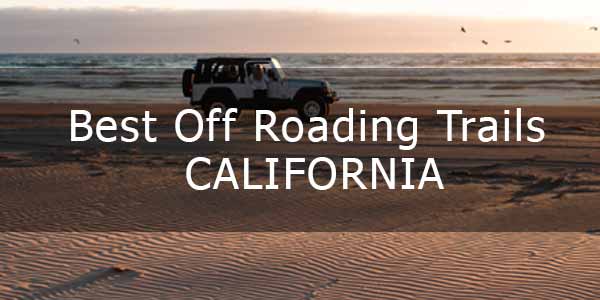
Whether you want an easy day or a difficult day, California offers it in many off roading trails. Some of the best places to go off roading in California are in San Bernardino. You can go from the desert to the top of the mountains to enjoy the amazing views all in the same day. Several trails have camping and lakes. Others offer scenic views of the desert and mountains.
Keep in mind that if you are starting at a low elevation and going to a high elevation, you might need a light jacket in the summer and will definitely need cold-weather and snow gear in the winter. You might need snow gear in the early spring and mid to late fall, too.
Quick Navigation
Cleghorn Ridge OHV Road
Skill Level: Intermediate
Distance: 14.4 miles
Elevation: Gain of 2,785 feet
Seasonality: Spring, Summer and Fall
Type of Trail and Unique Traits
Cleghorn Ridge Trail is in the San Bernardino National Forest and is one of the best off road trails in Southern California. You can choose a scenic fire road or a 4×4 trail. You’ll get a ridge top view of Mount Baldy, along with excellent desert and mountain views. There are many bypasses so you can get around offshoots that might be too difficult for you. You could get hung up on two spots on the fire road – one is an easier climb, but the other spot is quite rutted.
A commenter said the road conditions are poor, so the road is most likely not maintained. If you take the offshoots, you need 4Low and clearance. The first part of the road is pretty easy, but the second part, starting around Mile 9 from I-15, the trail is washed out and has ruts and rock obstacles.
Starting and Ending Points
Start at the Cleghorn off-ramp for Interstate 15 in Cajon Pass. The trail ends at State Highway 138 in Lake Silverwood.
Obstacles on the Trail
Ruts, rocks.
Burns Canyon
Skill Level: Easy
Distance: 19.06 miles
Elevation: 7,127 feet (highest point)
Seasonality: Spring, summer and fall.
Type of Trail and Unique Traits
The Burns Canyon Trail is in a high desert area that features Yucca, Joshua trees and more. It goes into the Big Bear forest and Arrastre Creek area. If you are interested in history, start at the south end in Pioneertown so you can visit the area before riding the trail. You’ll travel through the Rose Mine and see redwoods.
The trail is dirt road in some parts and rocky road in other parts. You might see rocks, stumps and vertical ledges less than 9 inches high. It does get steep in places. As you climb, the weather gets much cooler, so be prepared for cold or cooler temperatures even if the bottom is hot. And, just because it’s rated “Easy,” don’t discount it as a good place to go off roading in Southern California.
The eastern part of the trail is on private property. Always drive with care and respect through the private property.
Starting and Ending Points
The Eastern Trailhead starts on private property. If you are coming from Pioneertown, this will be the end of the trail. The Western Trailhead is in a residential area in Pioneertown. To find the starting point in Pioneertown, follow Pioneertown Road to Rim Rock Road. Turn left off Rim Rock Road onto Burns Canyon Road. The trailhead is about 8 miles from the turn and is marked with a small sign that reads 2N02.
Obstacles on the Trail
You’ll have to maneuver small rocks and stumps, low drop-offs, and waterfalls that are less than 12 inches high.
Heartbreak Ridge
Skill Level: Moderate to Difficult
Distance: 8.9 miles
Elevation: 6,800 feet
Seasonality: Spring, Summer and Fall
Type of Trail and Unique Traits
If you want a less-traveled trail, the Heartbreak Ridge trail is on the east side of Big Bear. The trail number is 2N61Y and has been all but forgotten by off-roaders. It is one of the hardest trails in the San Bernardino Forest and is perfect for exploring. It features many rock gardens and spots with high rollover risks among some of the concerns.
Heartbreak Ridge also offers dispersed camping and beautiful views. However, the sites are not improved, and in most cases, fires are not allowed. You can also see mining sites. You will need 4Low and high clearance to navigate this trail.
Starting and Ending Points
The starting point is in Big Bear City. To access the east side, go south off 2N02 at Waypoint 2 and head west. The west side starts at Waypoint 9 on 2N02 and runs west.
Obstacles
This trail has several rock gardens, a narrow canyon that is difficult, and spots with high rollover risks. Your vehicle could suffer from body damage, moderate off-camber, and pinstriping. Two of the rock gardens are rated a 3 and a 5.
Red Lake Trail
Skill Level: Difficult
Distance: 2.4 miles
Elevation: 9,028
Seasonality: June 15 through November 1
Type of Trail and Unique Traits
Red Lake Trail takes you to the lake and camping at the end of a grueling 4×4 trail. The trail is a mixture of short stretches of easy trail and lots of rock gardens and a dense forest. The trail is part of the Red Mountain OHV network and is located in the Sierra National Forest between Shaver Lake and Huntington Lake. While the trail is difficult, it is “easy” compared to Coyote Lake Trail and Mirror Lake Trail.
You will need a four-wheel drive vehicle with a lift and larger tires to navigate the trail. Your vehicle should also be equipped with under armor and rock sliders.
Starting and Ending Points
Start at the east end of the sand flats and follow the signs. The area has a few campsites with a vault toilet. The end of the trail is at the Coyote Lake Trail Gate Keeper, where you can also set up camp.
Obstacles on the Trail
Obstacles include rocks, tree stumps, vertical ledges less than 24 inches tall, and waterfalls less than 54 inches. Tire placement is often difficult. Wider vehicles might not fit. You can expect body damage, mid off-camber and pinstriping.
Coyote Lake Trail
Skill Level: Difficult
Distance: 1.7 miles
Elevation: 9,169
Seasonality: June 15 through November 1
Type of Trail and Unique Traits
If you want a challenging ride, the Coyote Lake Trail will fulfill your wishes. This 4×4 trail runs from Red Lake to Coyote Lake. After a heavy day of rock crawling, enjoy fishing, swimming and camping high in the mountains. The Coyote Lake Trail is just one of many in the Sierra National Forest.
If you thought Red Lake Trail was bad, get ready – Coyote Lake Trail starts with a rock obstacle at the head of the trail and doesn’t have a smooth spot until you reach the lake.
Starting and Ending Points
Coyote Lake Trail starts at the end of Red Lake Trail at the Gate Keeper rock obstacle. The end is at the lake. You can go further on a hiking trail, but this is as far as road vehicles can go. The only way out is the way you came in.
Obstacles on the Trail
Expect body damages and moderate off-camber. The entire trail is rocky, with rocks and vertical ledges up to 36 inches high. You might have to navigate waterfalls less than 84 inches. Tire placement is difficult.
Mirror Lake Trail
Skill Level: Severe
Distance: 1.3 miles
Elevation: 8,972 feet at the highest point
Seasonality: All except winter
Type of Trail and Unique Traits
If you’ve got the guts for possible rollovers and don’t mind winching yourself across some rocks, this is the perfect trail for you. Mirror Lake Trail starts at Strawberry Trail and goes up to Mirror Lake. You’ll have to take Strawberry Lake trail to get to Mirror Lake trail, though that trail is easy to intermediate. Winch Hill starts at Waypoint 5, and it’s very slow-going. The trail is in the Sierra National Forest. Once you get to the end, your reward is camping, swimming and fishing.
Starting and Ending Points
Start at Strawberry Lake Trail and end at Mirror Lake.
Obstacles on the Trail
With this trail, you’ll have to drive over tons of rocks. The trail is steep and has winch posts drilled into the rock in two places. It is mild off-camber in some places and moderate off-camber in other places. It also gets narrow. Expect body damage.
Clarks Grade
Skill Level: Easy to Intermediate
Distance: 7.5 miles
Elevation: 7,804 feet
Seasonality: Year-round
Type of Trail and Unique Traits
This off-road trail is in the San Bernardino National Forest and is easy for the most part. However, places in the dirt have rock slides and washouts. You’ll travel through several ecosystems from the lush canyon bottom through mesquite and sage and up through conifers before the trail opens up above the tree line. The trail has dispersed and designated camping.
Starting and Ending Points
The trail (IN54) is just west of Seven Oaks Road and north of the white bridge that crosses the Santa Ana River. Once you go about 475 feet on Seven Oaks Road, turn left on IN09 for about 0.2 miles, then take the Clarks Grade trailhead to the left.
Obstacles on the Trail
Most times, there are no obstacles. Some have made the full drive in two-wheel drive. However, it does get rocky and has ruts after rains.
The Squeeze
Skill Level: Intermediate to Difficult
Distance: 1.3 miles
Elevation: 7,600 feet
Seasonality: Year-round
Type of Trail and Unique Traits
This short trail (3N07A) has two unique obstacles. The first one is the Squeeze, which is really narrow. Though you can make it without a spotter, it is better to have one; else, you might scrape your Jeep. The second is Coyote Crag rock formation, which is a rock garden. There are plenty of views and tons of camping on the trail. At the end, you can easily fit a group of 20 vehicles.
Starting and Ending Points
The trail starts at the Big Bear Discovery Center and is the southern trailhead.
Obstacles on the Trail
The super-narrow spot between two huge boulders, plus a rock garden that is fun to navigate.
Powder Hill
Skill Level: Intermediate
Distance: 0.8 mile
Elevation: 7,220 feet
Seasonality: Year-round
Type of Trail and Unique Traits
Powder Hill is a part of the Bald Mountain OHV Trail network. It is in Fresno, near Shaver Lake, in the Sierra National Forest. You’ll see excellent views and climb one of the longest hills in this trail system. It is also one of the steepest hills.
Starting and Ending Points
Take the Bald Mountain Trail off Rock Creek Road for 0.3 miles and go straight at the 26E330 sign. The trail ends at the top of the mountain.
Obstacles on the Trail
A very steep rocky hill, though the rocks do not have steep drop-offs.
Little Round Mountain Road
Skill Level: Easy
Distance: 1.5 miles
Elevation: 3,238 feet
Seasonality: Year-round
Type of Trail and Unique Traits
This road goes about 1.5 miles then narrows to a single-track trail. It goes through a pine forest and has views of Bucknell Creek that are seasonal. This is a trail you want to take if you wish to some improved camping and a chance to get some pictures of red-tailed hawks.
Starting and Ending Points
The starting point is Waypoint 6 on the M1 – Elk Mountain Road.
Obstacles on the Trail
None.